
Underwater Asset Intelligence
For hydropower and critical infrastructure
Current focus: developing and validating autonomous underwater survey and engineering-ready 3D data workflows. Building toward broader Asset Intelligence and decision support.

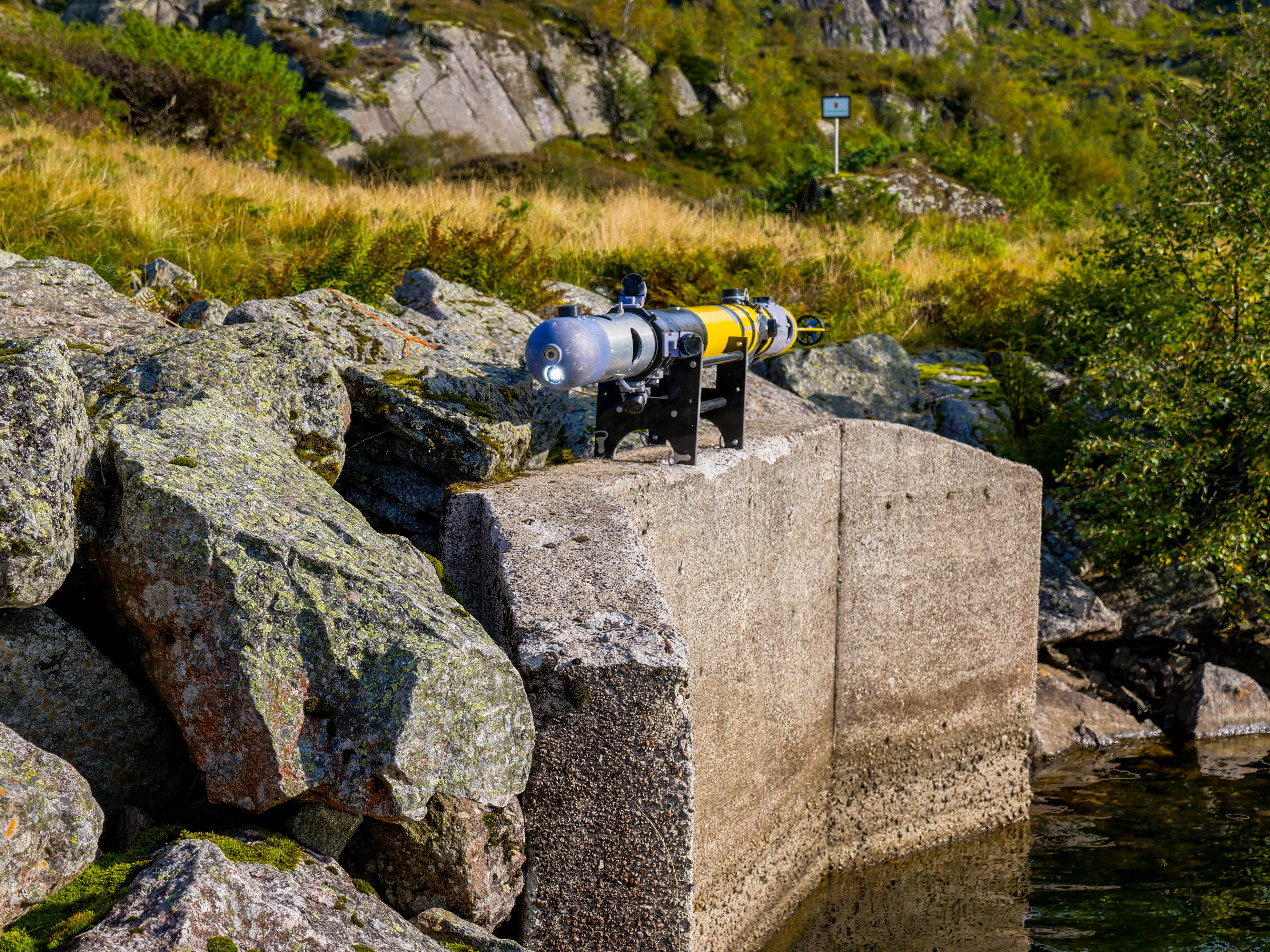
The missing submerged layer of Asset Intelligence
SASSAS is developing a vehicle- and sensor-agnostic Underwater Asset Intelligence architecture for critical infrastructure. Current work focuses on autonomous underwater survey in GNSS-denied environments and on turning multi-sensor survey data into engineering-ready 3D geometry and structured information. Hydropower is the first market, with water-filled tunnels, waterways, dams, intakes and outlets as the initial focus. The operational system, autonomous navigation and repeatability are still being matured through controlled and field validation. In parallel, processing workflows, Tunnel Viewer and the underlying asset data model are being developed toward repeatable baselines, survey-to-survey comparison, asset history and broader decision support.
Where SASSAS is today
SASSAS is in active system development and validation. Operational capability, autonomy, processing and the broader Asset Intelligence architecture are being matured in parallel, with each layer validated before it is presented as production-ready.
Field & AUV Development
Field campaigns in hydropower have generated operational data and lessons that are feeding directly into continued AUV, system-integration and operating-procedure development. The next phase prioritises controlled validation before renewed full tunnel deployment.
GNSS-Denied Navigation
Autonomous navigation, centring, mission behaviours, return logic and fault handling are under integration and validation. Repeatable bidirectional performance is a key objective before the next full tunnel campaign.
Processing & Tunnel Viewer
Processing workflows and standards are being developed for multi-sensor survey data, 3D point clouds, geometry, profiles and cross-sections. Tunnel Viewer is an active development environment for visualisation and analysis, with functionality expanding as data quality and processing workflows mature.
Asset Intelligence
The underlying data model and architecture are being developed to connect multiple surveys to a persistent asset record, enabling future baseline registration, quantified change, historical trend and wider decision support across the organisation.
Processing & Tunnel Viewer
SASSAS is developing a structured processing workflow and Tunnel Viewer for turning multi-sensor survey data into navigable 3D geometry, cross-sections and engineering views. The processing and intelligence layer is being designed to remain sensor- and vehicle-agnostic, allowing data from different inspection platforms and sensor suites to feed the same review workflow. The examples below show representative development outputs from processed survey geometry. They are not presented as final client deliverables or certified accuracy statements.
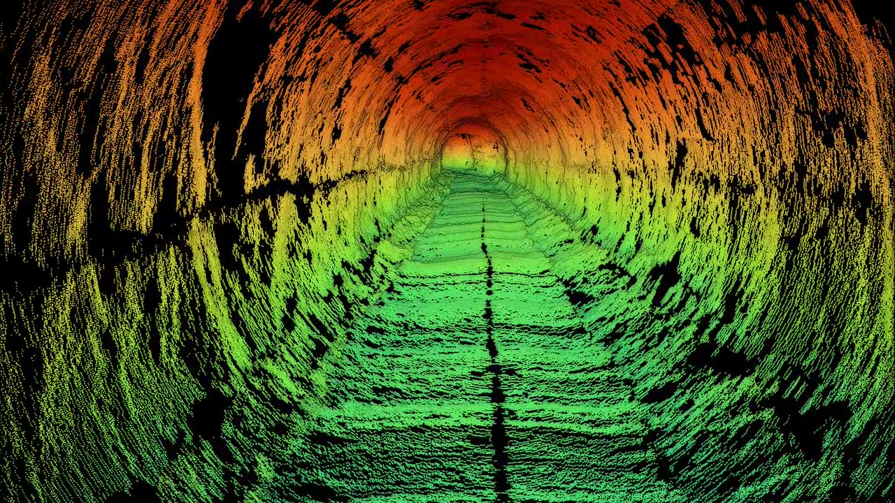
Processed 3D tunnel geometry
Representative processed point-cloud geometry used to examine tunnel shape, continuity and spatial structure.
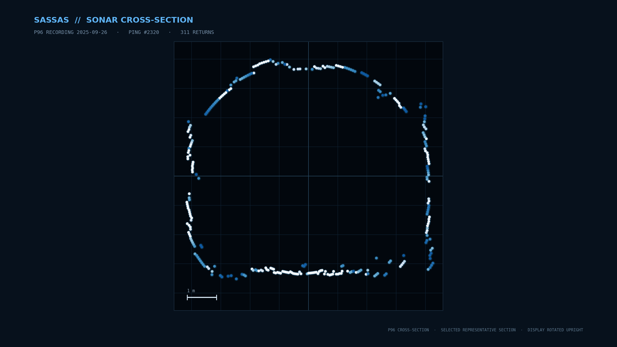
Cross-sections & geometry
Cross-sectional views support dimensional analysis, profiles and the development of repeatable survey-to-survey comparison.
Tunnel Viewer fly-through
An inside-the-tunnel development view for navigating processed point-cloud geometry and reviewing spatial continuity along the asset.
Development-stage visualisations · representative processed survey geometry · capability and output quality continue to be validated.
From submerged reality to engineering decisions
Hydropower-first. Vehicle- and sensor-agnostic. Designed for interoperable underwater systems.
Why this matters:
Inspect Without Dewatering
Submerged inspection can reduce or avoid the need to drain water-filled assets, limiting operational disruption and the risks associated with dewatering aging infrastructure.
Reduce Mobilisation and Site Impact
Compact autonomous and remotely operated systems can reduce heavy lifting, large crews and complex site logistics, particularly at remote or difficult-access hydropower locations.
Operate in GNSS-Denied and Confined Environments
Water-filled tunnels and submerged structures are often beyond conventional survey methods. SASSAS is developing autonomous underwater survey workflows for GNSS-denied environments, with multi-sensor data captured for structured onshore processing, 3D reconstruction and engineering analysis.
Build Toward Engineering-Ready Digital Baselines
Processing workflows are being developed to transform survey data into 3D point clouds, meshes, profiles, cross-sections and quantified geometry, with the aim of creating traceable digital baselines for engineering assessment and future comparison.
Build Toward Comparable Asset History
As the capability develops, repeated surveys can be registered to the same asset baseline so change can be quantified over time, supporting maintenance planning, risk assessment and long-term asset management.
From survey data to shared asset understanding
Submerged asset information is often fragmented across inspection reports, engineering files, operational records and individual departments. SASSAS is developing an architecture intended to create a common, traceable view of submerged asset condition over time, while keeping the customer’s survey and asset data under customer ownership. As the capability matures, the same underlying data and asset history can support decisions across the organization rather than ending as an isolated inspection deliverable.
Engineering & Maintenance
Use engineering-ready 3D geometry, profiles and cross-sections to support assessment and planning. As the Asset Intelligence capability matures, survey-to-survey change can add a stronger basis for maintenance and intervention decisions.
Operations
Gain a clearer view of submerged constraints and condition when planning access, outages, inspections and operational follow-up.
Asset Management & Risk
Build toward repeatable baselines and asset history that can support prioritisation, lifecycle planning, risk assessment and defensible condition records.
Management & Finance
Use a shared evidence base to support decisions around maintenance priorities, capital allocation, life extension, operational risk and future production-impact analysis.
Intelligence that compounds over time
The first survey creates a structured digital baseline. Each later survey can add more value by registering new information to the same asset record, making change measurable, history stronger and decisions better informed.
The first survey creates value. Every subsequent survey can make the asset record more valuable — moving from isolated inspections toward a continuously improving understanding of the asset.
Markets
Hydropower modernisation increases the need for reliable condition knowledge of civil and submerged infrastructure that is difficult to access. SASSAS is focused first where better information can materially improve safety, availability, maintenance planning and investment decisions.
Hydropower
Water-filled tunnels and waterways, dams, intakes, outlets and other submerged generation infrastructure.
Water Infrastructure
Water-supply tunnels, reservoirs, intakes and other difficult-to-access submerged utility assets.
Offshore & Marine Infrastructure
Selected offshore-energy, port and inshore assets where autonomous survey and structured 3D asset information create clear value.
Secondary markets will be pursued selectively as the core survey, processing and Asset Intelligence capabilities mature.
Field Development & Validation
SASSAS develops and validates underwater survey and data workflows through controlled and representative test environments in Norway and elsewhere in Europe, including alongside technology partners during vehicle development. Field campaigns have provided real operational data and lessons that are being incorporated into continued vehicle and system development. Current priorities include robust system integration, autonomous navigation, sensing, repeatability and downstream data quality, with controlled validation used before the next full tunnel campaign. The objective is not simply autonomous operation, but repeatable and traceable survey information that can support engineering assessment and comparison across the life of an asset.


Talk to SASSAS
If you manage submerged hydropower or other critical infrastructure, we would like to discuss the inspection challenges, data gaps and decisions you need better information to support.
Follow SASSAS
Follow the development of SASSAS’ Underwater Asset Intelligence capabilities, hydropower field validation and new approaches to understanding submerged infrastructure.

Founder and CEO of SASSAS, focused on transforming underwater inspection data into practical intelligence for safer, more efficient infrastructure management.